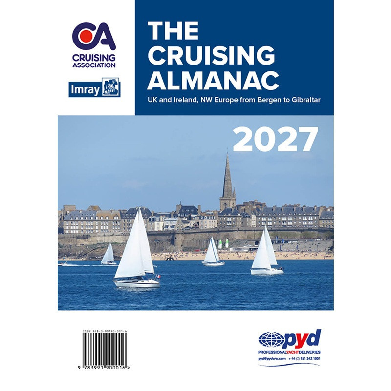


Covering the coasts and islands of the British Isles together with north-west Europe from Bergen and down to Gibraltar, the Cruising Almanac remains the trusted companion for cruising sailors.
Covering the coasts and islands of the British Isles together with north-west Europe from Bergen and down to Gibraltar, the Cruising Almanac remains the trusted companion for cruising sailors.
The Cruising Almanac was first published in 1909 as Sailing Directions within the Cruising Association Handbook. Almost a century later, in 2002, it became The Cruising Almanac, published by Imray.
Drawing on the first-hand experience of CA members and an expert editorial team, combined with Imray’s preeminent cartography and publishing, the Cruising Almanac remains an essential resource that no cruising sailor should be without.
What’s new in this edition?
Every edition of the CA Cruising Almanac is reviewed and updated to reflect changing navigation requirements, member feedback and the latest available information. Highlights of the 2027 edition include:
• A reorganised western Scotland section, with mainland locations separated from those in the Hebrides, making it easier to plan cruises through one of Britain's most popular cruising areas.
• Completely reviewed coverage of the Rivers Swale and Medway, together with the Menai Strait, incorporating buoyage changes and updated guidance for these challenging waters.
• Extensively updated harbour plans throughout the Almanac, including a revised plan for Gothenburg with enhanced berthing information.
• New plans and locations, including a detailed approach plan for Wisbech and a brand-new entry for Rhu on Scotland's west coast.
• Improved tide tables, with spring and neap tides now clearly identified for quick reference.
Authoritative Nautical Pilotage for the British Isles and NW Europe
Trusted as the go-to on board reference for sail and motor cruisers, the Cruising Almanac covers the coasts and islands of Great Britain and Ireland, from the Shetlands southwards, together with the continental coastline from Bergen, through the approaches to the Baltic, and as far south as Gibraltar.
It serves as a comprehensive guide for planning safe passage in and out of harbours, rivers and anchorages, as well as discovering new waters. Imray’s expertise is evident in the detailed full-colour chartlets that accompany most entries. With comprehensive information on almost every harbour and a multitude of anchorages, the Cruising Almanac is the perfect starting point for your cruising plans.
Published in a convenient A4 size, the Cruising Almanac is designed for easy reference even in tough sea conditions. Passage notes are prominently highlighted within the main text. Tidal stream plans and full tidal details for secondary ports are included alongside the relevant port information, while a supplementary booklet provides tide tables for 47 standard ports. The expertise of Imray is evident in the full colour, detailed chartlets which accompany most entries.
Easy-to-Use Layout
The Cruising Almanac design and layout features reader-friendly colour coding to easily navigate essential information, including navigational details and contact information.
The chartlets align closely with the relevant text, ensuring that critical information is always at your fingertips. Chartlets incorporate the latest hydrographic data and insights from local regional experts, providing sailors with the most accurate and up-to-date information.
Ports of entry are prominently listed at the start of each relevant chapter, making it easy to find key entry points. The 2027 edition includes the latest regulations for ports of entry, along with updated EU customs and immigration formalities, ensuring that you are well-prepared for your trip.
Up to Date
The Cruising Almanac is unique in being compiled by cruising sailors for cruising sailors, drawing on the first-hand experience of CA members throughout its coverage area. All sections, both text and plans, are thoroughly reviewed and updated to reflect changes to harbours, buoyage, facilities and navigational information, ensuring sailors have access to the latest practical guidance.
Alongside official information from harbour authorities, marinas and Notices to Mariners, the editorial team incorporates thousands of observations and updates submitted by CA members and through the CAptain's Mate app. Contributions from the CA's Regulatory & Technical Services Group (RATS) further enhance the Essential Cruising Information section with expert advice and guidance. This combination of official sources and first-hand cruising experience makes the Cruising Almanac one of the most trusted cruising references available.
Corrections and updates are published throughout the year on the CA website. Readers can subscribe to a free monthly email update service, ensuring you always have the latest information.
Order your copy today.
Covering the coasts and islands of the British Isles together with north-west Europe from Bergen and down to Gibraltar, the Cruising Almanac remains the trusted companion for cruising sailors.