")
")
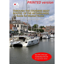
This guide covers the so-called Standing Mast Routes which consist of over 1,000 kms of accessible waterways and while many yachts use them just as a convenient inland route to the Baltic, they represent an unrivalled cruising ground in their own right for any yacht with draught of up to 2.5m and mast height of up to 33.9m (depending on route).
Several hundred yachts make a beeline for The Netherlands each year as the only European country in which mast-up yachts can cruise extensively on the inland waterways, visiting such historic cities as Leiden, Delft and Amsterdam or the beautiful lakes of Friesland.
The so-called Standing Mast Routes consist of over 1,000 kms of accessible waterways and while many yachts use them just as a convenient inland route to the Baltic, they represent an unrivalled cruising ground in their own right for any yacht with draught of up to 2.5m and mast height of up to 33.9m (depending on route).
Obtaining up-to-date information on the routes and on alternative cruising areas is vital, since disruptions are common owing to the number of lifting bridges. The Cruising Association aims to fill this gap with the launch in 2026 of this new guide to Cruising the Standing Mast Routes of the Netherlands, designed to provide all the information needed for a safe and enjoyable visit. The new guide complements the CA’s existing guides Through the Netherlands via the Standing Mast Routes, which is aimed at yachts just transiting the country, and 50 Great Cruising Routes in the Netherlands, which is aimed at motor boats with maximum air draft of 4.0m.
Published by the CA’s European Inland Waterways Section (EIWS) and authored by Dutch CA members Machiel Lambooij and Remko Sinck, the new guide contains advice on practical aspects of cruising the routes such as immigration and customs; sea approaches and access points; navigation and charts; information on bridges, locks and route distances; tidal/current and weather considerations; alternative routes and worthwhile detours; refuelling points and navigation rules. It also includes details and photos of the best moorings and facilities on the various routes; historic cities and towns; important local attractions and useful transport links.
Note that this is the printed version of the guide, supplied through the Lulu print on demand service. The digital (PDF) version of the guide can be purchased, or downloaded free for members, here.
Data sheet
This guide covers the so-called Standing Mast Routes which consist of over 1,000 kms of accessible waterways and while many yachts use them just as a convenient inland route to the Baltic, they represent an unrivalled cruising ground in their own right for any yacht with draught of up to 2.5m and mast height of up to 33.9m (depending on route).